
Make a donation
Gear up for your next adventure:
As an Amazon Associate, this site earns from qualifying purchases at no extra cost to you.
Pryor Creek topographic map
Click on the map to display elevation.
Make a donation
Gear up for your next adventure:
As an Amazon Associate, this site earns from qualifying purchases at no extra cost to you.
About this map
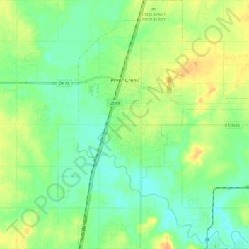
Name: Pryor Creek topographic map, elevation, terrain.
Location: Pryor Creek, Mayes County, Oklahoma, United States (36.24938 -95.34592 36.33632 -95.25620)
Average elevation: 623 ft
Minimum elevation: 577 ft
Maximum elevation: 686 ft
Mayes County trails, hiking, mountain biking, running and outdoor activities
Make a donation
Gear up for your next adventure:
As an Amazon Associate, this site earns from qualifying purchases at no extra cost to you.
Other topographic maps
Click on a map to view its topography, its elevation and its terrain.
Make a donation
Gear up for your next adventure:
As an Amazon Associate, this site earns from qualifying purchases at no extra cost to you.
Adair
United States > Oklahoma > Mayes County > Adair
Adair lies 10 miles (16 km) north of Pryor on U.S. Route 69 in Mayes County. The city is in the northeastern portion of the state known as "Green Country" and is near the borders of Kansas, Missouri, and Arkansas. Adair's geographic coordinates are 36°26′13″N 95°15′45″W / 36.43694°N…
Average elevation: 676 ft
Make a donation
Gear up for your next adventure:
As an Amazon Associate, this site earns from qualifying purchases at no extra cost to you.