Geolocate

White topographic map

Click on the map to display elevation.

About this map

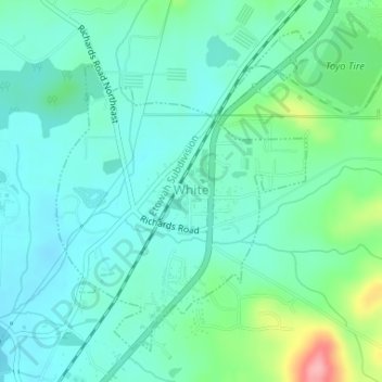
Name: White topographic map, elevation, terrain.

Location: White, Bartow County, Georgia, United States (34.27145 -84.75677 34.29412 -84.73538)

Average elevation: 889 ft

Minimum elevation: 797 ft

Maximum elevation: 1,201 ft

Bartow County trails, hiking, mountain biking, running and outdoor activities

Other topographic maps

Click on a map to view its topography, its elevation and its terrain.

Rydal

United States > Georgia > Bartow County

Average elevation: 896 ft

Weiss Lake

United States > Georgia > Bartow County > Cartersville

Average elevation: 906 ft

Emerson

United States > Georgia > Bartow County > Emerson

Average elevation: 873 ft

Gear up for your next adventure:

🧦Hiking Socks - Comfortable socks to prevent blisters on long hikes
🔊Portable Camp Speaker - Music and alerts at camp
🩳Quick‑Dry Hiking Shorts - Comfortable and quick‑dry shorts for summer hiking
🚑Emergency Bivvies - Heat-reflective sleeping bags for survival situations
🧼Biodegradable Camping Soap - Eco‑friendly soap for outdoor hygiene

As an Amazon Associate, this site earns from qualifying purchases at no extra cost to you.