
Vardø topographic map
Click on the map to display elevation.
About this map
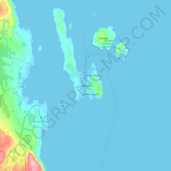
Name: Vardø topographic map, elevation, terrain.
Location: Vardø, Finnmark, 9950, Norway (70.33019 31.06772 70.41019 31.14772)
Average elevation: 33 ft
Minimum elevation: -33 ft
Maximum elevation: 551 ft
Other topographic maps
Click on a map to view its topography, its elevation and its terrain.
Alta
The town of Alta and most of the municipality is located just below the 70th latitude and is closer to the North Pole than it is to much of Central Europe and the British Isles. The town is the northernmost settlement of urban significance in the European Economic Area, with municipalities north of Alta being…
Average elevation: 1,220 ft