Geolocate

Adstock topographic map

Click on the map to display elevation.

About this map

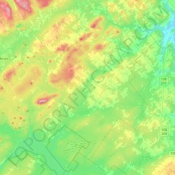
Name: Adstock topographic map, elevation, terrain.

Location: Adstock, Les Appalaches, Chaudière-Appalaches, Quebec, G0N 1S0, Canada (45.92440 -71.25675 46.17502 -70.98761)

Average elevation: 1,191 ft

Minimum elevation: 696 ft

Maximum elevation: 2,254 ft

Other topographic maps

Click on a map to view its topography, its elevation and its terrain.

Vimy-Ridge

Canada > Quebec > Les Appalaches

Average elevation: 1,129 ft

Saint-Daniel

Canada > Quebec > Les Appalaches > Adstock

Average elevation: 1,184 ft

Lac-à-la-Truite

Canada > Quebec > Les Appalaches > Adstock

Average elevation: 1,398 ft

Gear up for your next adventure:

🩹Survival Bandages - High‑quality bandages for emergencies
🏔️Mountain Trail Maps - High‑detail maps for popular peaks
🗃️Trail First Aid Kit - Essential kit for outdoor injuries and emergencies
🕶️Glacier Sunglasses - Side shields to protect eyes from high-altitude snow glare
🎒Outdoor Daypacks - Lightweight backpacks designed for carrying maps and essential gear

As an Amazon Associate, this site earns from qualifying purchases at no extra cost to you.