Geolocate

Vimy-Ridge topographic map

Click on the map to display elevation.

About this map

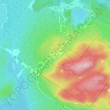
Name: Vimy-Ridge topographic map, elevation, terrain.

Location: Vimy-Ridge, Saint-Joseph-de-Coleraine, Les Appalaches, Chaudière-Appalaches, Quebec, G0N 1B0, Canada (45.98861 -71.43849 46.02861 -71.39849)

Average elevation: 1,129 ft

Minimum elevation: 761 ft

Maximum elevation: 1,808 ft

Other topographic maps

Click on a map to view its topography, its elevation and its terrain.

Thetford Mines

Canada > Quebec > Les Appalaches

Average elevation: 1,365 ft

Sainte-Praxède

Canada > Quebec > Les Appalaches

Average elevation: 1,030 ft

Adstock

Canada > Quebec > Les Appalaches

Average elevation: 1,191 ft

Irlande

Canada > Quebec > Les Appalaches

Average elevation: 1,119 ft

Saint-Fortunat

Canada > Quebec > Les Appalaches

Average elevation: 1,424 ft

Kinnear's Mills

Canada > Quebec > Les Appalaches

Average elevation: 1,342 ft

Disraeli (ville)

Canada > Quebec > Les Appalaches

Average elevation: 896 ft

Saint-Joseph-de-Coleraine

Canada > Quebec > Les Appalaches

Average elevation: 1,079 ft

Gear up for your next adventure:

🦶Carbon Trekking Poles - Reduce knee impact on steep descents with ultra-light poles
🎒Waterproof Dry Bags - Keep your electronics and maps dry inside your pack
🔥Fast-Boil Camping Stoves - Efficient cooking systems for quick trail meals
🎁Geography Themed Gifts - Unique gift ideas for map lovers and geography enthusiasts
🥾Women's Hiking Boots - Top-rated trail boots with ankle support and superior grip

As an Amazon Associate, this site earns from qualifying purchases at no extra cost to you.