Geolocate

Mound City topographic map

Click on the map to display elevation.

About this map

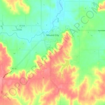
Name: Mound City topographic map, elevation, terrain.

Location: Mound City, Linn County, Kansas, 66056, United States (38.10968 -94.89664 38.14963 -94.79678)

Average elevation: 945 ft

Minimum elevation: 820 ft

Maximum elevation: 1,102 ft

Linn County trails, hiking, mountain biking, running and outdoor activities

Other topographic maps

Click on a map to view its topography, its elevation and its terrain.

Farlinville

United States > Kansas > Linn County

Average elevation: 876 ft

Centerville

United States > Kansas > Linn County

Average elevation: 942 ft

Gear up for your next adventure:

🪶Survival Guide Book - Expert advice for emergency preparedness
🎒Outdoor Daypacks - Lightweight backpacks designed for carrying maps and essential gear
🧭Pro Hiking Compasses - High-accuracy liquid-filled compasses for topographic orientation
🥾Women's Hiking Boots - Top-rated trail boots with ankle support and superior grip
🧤Hiking Gloves - Protective gloves for rugged trails

As an Amazon Associate, this site earns from qualifying purchases at no extra cost to you.