Geolocate

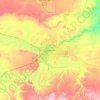
Eden Bridge topographic map

Click on the map to display elevation.

About this map

Name: Eden Bridge topographic map, elevation, terrain.

Location: Eden Bridge, Cascade County, Montana, United States (47.23515 -111.39027 47.23658 -111.38801)

Average elevation: 3,642 ft

Minimum elevation: 3,435 ft

Maximum elevation: 4,032 ft

Other topographic maps

Click on a map to view its topography, its elevation and its terrain.

Great Falls

United States > Montana > Cascade County

Average elevation: 3,445 ft

Great Falls

United States > Montana > Cascade County > Great Falls

Average elevation: 3,520 ft

Stockett

United States > Montana > Cascade County

Average elevation: 3,816 ft

Vaughn

United States > Montana > Cascade County

Average elevation: 3,392 ft

Ulm

United States > Montana > Cascade County

Average elevation: 3,432 ft

Hardy

United States > Montana > Cascade County

Average elevation: 3,701 ft

Great Falls

United States > Montana > Cascade County

Average elevation: 3,445 ft

Black Eagle

United States > Montana > Cascade County

Average elevation: 3,432 ft

Gear up for your next adventure:

🗺️NatGeo Topo Maps - High-quality waterproof printed topographic maps of US Parks
🚪Portable Camp Chair - Foldable chair for comfort at camp
🧭Outdoor Navigation Book - Learn advanced navigation skills
🕶️GPS Smartphone Mount - Secure mount for phone navigation
🔦LED Headlamp - Bright and durable LED headlamp for night navigation

As an Amazon Associate, this site earns from qualifying purchases at no extra cost to you.