
Make a donation
Gear up for your next adventure:
As an Amazon Associate, this site earns from qualifying purchases at no extra cost to you.
Giron topographic map
Click on the map to display elevation.
Make a donation
Gear up for your next adventure:
As an Amazon Associate, this site earns from qualifying purchases at no extra cost to you.
Giron
The town of Girón is located 44 km southwest of Cuenca by road, at an elevation of 2160 m.
Make a donation
Gear up for your next adventure:
As an Amazon Associate, this site earns from qualifying purchases at no extra cost to you.
About this map
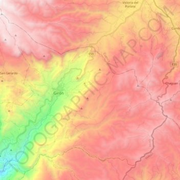
Name: Giron topographic map, elevation, terrain.
Location: Giron, Girón, Azuay, Ecuador (-3.25134 -79.22803 -3.06469 -79.02183)
Average elevation: 9,432 ft
Minimum elevation: 4,469 ft
Maximum elevation: 12,464 ft
Make a donation
Gear up for your next adventure:
As an Amazon Associate, this site earns from qualifying purchases at no extra cost to you.
Other topographic maps
Click on a map to view its topography, its elevation and its terrain.