Geolocate
👉 Easily get elevation data in JSON, GeoTIFF and KML formats using Elevation API
Thank you for supporting this site ❤️
Make a donation

Giron topographic map

Click on the map to display elevation.

Giron

The town of Girón is located 44 km southwest of Cuenca by road, at an elevation of 2160 m.

Wikipedia (CC-BY-SA 3.0)

About this map

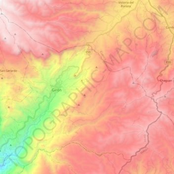
Name: Giron topographic map, elevation, terrain.

Location: Giron, Girón, Azuay, Ecuador (-3.25134 -79.22803 -3.06469 -79.02183)

Average elevation: 9,432 ft

Minimum elevation: 4,469 ft

Maximum elevation: 12,464 ft

Other topographic maps

Click on a map to view its topography, its elevation and its terrain.

Lentag

Ecuador > Azuay > Girón

Average elevation: 4,931 ft

Gear up for your next adventure:

🪶Trail Camera - Capture wildlife on your hikes
🔋Solar Power Banks - Keep your GPS and phone charged in remote wilderness areas
☀️Outdoor Sunscreen - High protection sunscreen for outdoor activities
🩳Quick‑Dry Hiking Shorts - Comfortable and quick‑dry shorts for summer hiking
🎒Trekking Poles - Sturdy poles for balance and stability on rough terrain

As an Amazon Associate, this site earns from qualifying purchases at no extra cost to you.