Geolocate

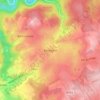
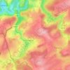
Tillet topographic map

Click on the map to display elevation.

About this map

Name: Tillet topographic map, elevation, terrain.

Location: Tillet, Sainte-Ode, Bastogne, Luxembourg, Wallonia, 6680, Belgium (49.95541 5.48706 50.03764 5.62971)

Average elevation: 1,526 ft

Minimum elevation: 1,181 ft

Maximum elevation: 1,880 ft

Other topographic maps

Click on a map to view its topography, its elevation and its terrain.
Provedroux

Belgium > Luxembourg > Bastogne

Average elevation: 1,535 ft

Ollomont

Belgium > Luxembourg > Bastogne > Houffalize

Average elevation: 1,234 ft

Fin de Ville

Belgium > Luxembourg > Bastogne > Houffalize

Average elevation: 1,322 ft

Bastogne

Belgium > Luxembourg > Bastogne > Bastogne

The municipality consists of the following districts: Bastogne, Longvilly, Noville, Villers-la-Bonne-Eau, and Wardin. The town is situated on a ridge in the Ardennes at an elevation of 510 metres (1,670 ft).

Average elevation: 1,657 ft
Assenois

Belgium > Luxembourg > Bastogne

Average elevation: 1,677 ft

Foy

Belgium > Luxembourg > Bastogne > Bastogne

Average elevation: 1,660 ft

Bertogne

Belgium > Luxembourg > Bastogne > Bastogne

Average elevation: 1,391 ft

Fraiture

Belgium > Luxembourg > Bastogne

Average elevation: 1,867 ft

Sainte-Ode

Belgium > Luxembourg > Bastogne

Average elevation: 1,371 ft

Ennal

Belgium > Luxembourg > Bastogne

Average elevation: 1,371 ft

Alhoumont

Belgium > Luxembourg > Bastogne > Houffalize

Average elevation: 1,398 ft

Baraque de Fraiture

Belgium > Luxembourg > Bastogne > Vielsalm

Average elevation: 2,001 ft

Wathermal

Belgium > Luxembourg > Bastogne > Gouvy

Average elevation: 1,604 ft

Provedroux

Belgium > Luxembourg > Bastogne

Average elevation: 1,535 ft

Ollomont

Belgium > Luxembourg > Bastogne > Houffalize > Nadrin

Average elevation: 1,234 ft

Baraque de Fraiture

Belgium > Luxembourg > Bastogne > Vielsalm

Average elevation: 2,001 ft

Gear up for your next adventure:

📶Vehicle Signal Boosters - Improve reception in rural areas while driving to trailheads
📦Dry Bags Set - Waterproof storage for electronics and clothes
🎒Day Hiking Backpack - Lightweight backpack perfect for day trips and outdoor adventures
📚USA Hiking Guide Books - Top trail guides and map books
🛡️Insect Repellent - Protection against bugs during outdoor activities

As an Amazon Associate, this site earns from qualifying purchases at no extra cost to you.