Geolocate

Fraiture topographic map

Click on the map to display elevation.

About this map

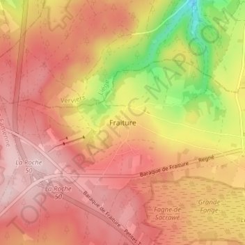
Name: Fraiture topographic map, elevation, terrain.

Location: Fraiture, Vielsalm, Bastogne, Luxembourg, Wallonia, 6661, Belgium (50.23776 5.73253 50.27776 5.77253)

Average elevation: 1,867 ft

Minimum elevation: 1,352 ft

Maximum elevation: 2,152 ft

Other topographic maps

Click on a map to view its topography, its elevation and its terrain.

Bastogne

Belgium > Luxembourg > Bastogne

The municipality consists of the following districts: Bastogne, Longvilly, Noville, Villers-la-Bonne-Eau, and Wardin. The town is situated on a ridge in the Ardennes at an elevation of 510 metres (1,670 ft).

Average elevation: 1,522 ft

Lavacherie

Belgium > Luxembourg > Bastogne

Average elevation: 1,450 ft

Houffalize

Belgium > Luxembourg > Bastogne

Average elevation: 1,519 ft

Nives

Belgium > Luxembourg > Bastogne

Average elevation: 1,532 ft

Fauvillers

Belgium > Luxembourg > Bastogne

Average elevation: 1,480 ft

Gouvy

Belgium > Luxembourg > Bastogne

Average elevation: 1,585 ft

Petit-Thier

Belgium > Luxembourg > Bastogne

Average elevation: 1,585 ft

Noville

Belgium > Luxembourg > Bastogne > Bastogne

Average elevation: 1,549 ft

Houffalize

Belgium > Luxembourg > Bastogne

Average elevation: 1,519 ft

Flamierge

Belgium > Luxembourg > Bastogne > Bastogne

Average elevation: 1,407 ft

Bihain

Belgium > Luxembourg > Bastogne > Vielsalm

Average elevation: 1,631 ft

Bastogne

Belgium > Luxembourg > Bastogne

The municipality consists of the following districts: Bastogne, Longvilly, Noville, Villers-la-Bonne-Eau, and Wardin. The town is situated on a ridge in the Ardennes at an elevation of 510 metres (1,670 ft).

Average elevation: 1,522 ft

Tillet

Belgium > Luxembourg > Bastogne

Average elevation: 1,526 ft

Wibrin

Belgium > Luxembourg > Bastogne > Houffalize

Average elevation: 1,404 ft

Bastogne

Belgium > Luxembourg > Bastogne

The municipality consists of the following districts: Bastogne, Longvilly, Noville, Villers-la-Bonne-Eau, and Wardin. The town is situated on a ridge in the Ardennes at an elevation of 510 metres (1,670 ft).

Average elevation: 1,522 ft

Nadrin

Belgium > Luxembourg > Bastogne > Houffalize

Average elevation: 1,250 ft

Gear up for your next adventure:

🪶Compact Camp Shovel - Folding shovel for campsite tasks
🪶LED Camping Lantern - Bright lantern for camp lighting
🔋Solar Power Banks - Keep your GPS and phone charged in remote wilderness areas
Backpacking Tent - Lightweight and durable tent for multi‑day hikes
🗺️NatGeo Topo Maps - High-quality waterproof printed topographic maps of US Parks

As an Amazon Associate, this site earns from qualifying purchases at no extra cost to you.