
Marowijne topographic map
Interactive map
Click on the map to display elevation.
About this map
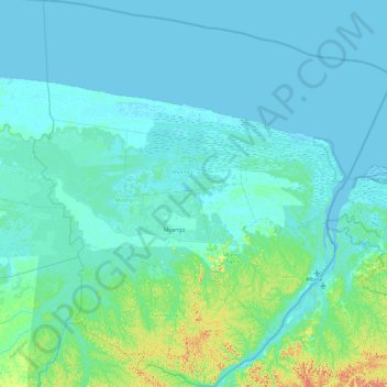
Name: Marowijne topographic map, elevation, terrain.
Location: Marowijne, Suriname (5.23391 -54.74928 6.18114 -53.86014)
Average elevation: 46 ft
Minimum elevation: -7 ft
Maximum elevation: 492 ft
Other topographic maps
Click on a map to view its topography, its elevation and its terrain.
Anna Marie
Suriname > Saramacca > Tijgerkreek > Anna Marie
Anna Marie, Tijgerkreek, Saramacca, Suriname
Average elevation: 16 ft
Paramaribo
Suriname > Paramaribo > Centrum
Paramaribo, Centrum, Paramaribo, Suriname
Average elevation: 10 ft