
Kabalebo topographic map
Interactive map
Click on the map to display elevation.
About this map
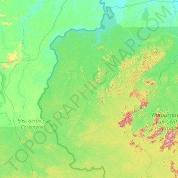
Name: Kabalebo topographic map, elevation, terrain.
Location: Kabalebo, Sipaliwini, Suriname (3.25761 -58.07083 5.34866 -56.22845)
Average elevation: 423 ft
Minimum elevation: 0 ft
Maximum elevation: 3,737 ft
Other topographic maps
Click on a map to view its topography, its elevation and its terrain.
Anna Marie
Suriname > Saramacca > Tijgerkreek > Anna Marie
Anna Marie, Tijgerkreek, Saramacca, Suriname
Average elevation: 16 ft
Paramaribo
Suriname > Paramaribo > Centrum
Paramaribo, Centrum, Paramaribo, Suriname
Average elevation: 10 ft