
Karzok topographic map
Click on the map to display elevation.
About this map
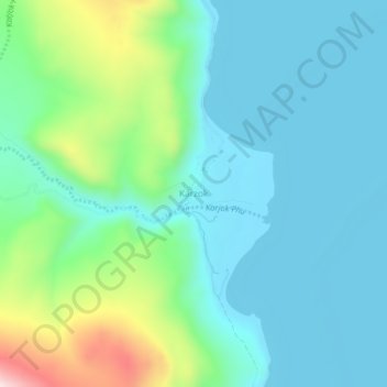
Name: Karzok topographic map, elevation, terrain.
Location: Karzok, Leh district, India (32.94613 78.24299 32.98613 78.28299)
Average elevation: 15,151 ft
Minimum elevation: 14,823 ft
Maximum elevation: 16,316 ft
Other topographic maps
Click on a map to view its topography, its elevation and its terrain.
Chennai
Chennai is located on the southeastern coast of India in the northeastern part of Tamil Nadu on a flat coastal plain known as the Eastern Coastal Plains with an average elevation of 6.7 m (22 ft) and highest point at 60 m (200 ft). Chennai's soil is mostly clay, shale and sandstone. Clay underlies most of the…
Average elevation: 26 ft
Bengaluru
India > Karnataka > Bangalore North
Bengaluru (formerly Bangalore) is situated in the southeastern part of Karnataka, India, within the Bengaluru Urban district. It lies at an elevation of approximately 900 meters (3,000 feet) above sea level, on the Deccan Plateau. This elevated position gives the city a moderate climate, with temperatures…
Average elevation: 2,890 ft
Mumbai
India > Maharashtra > Mumbai
Mumbai is on a narrow peninsula on the southwest of Salsette Island, which lies between the Arabian Sea to the west, Thane Creek to the east and Vasai Creek to the north. Mumbai's suburban district occupies most of the island. Navi Mumbai is east of Thane Creek and Thane is north of Vasai Creek. Mumbai…
Average elevation: 59 ft
Hyderabad
India > Telangana > Bahadurpura mandal
Hyderabad (/ˈhaɪdərəbæd/ HY-dər-ə-bad; Telugu: [ˈɦaɪ̯daraːbaːd], Urdu: [ˈɦɛːdəɾaːbaːd]) is the capital and largest city of the Indian state of Telangana. It occupies 650 km2 (250 sq mi) on the Deccan Plateau along the banks of the Musi River, in the northern part of Southern India. With an…
Average elevation: 1,801 ft
Chennai
Chennai is located on the southeastern coast of India in the northeastern part of Tamil Nadu on a flat coastal plain known as the Eastern Coastal Plains with an average elevation of 6.7 m (22 ft) and highest point at 60 m (200 ft). Chennai's soil is mostly clay, shale and sandstone. Clay underlies most of the…
Average elevation: 26 ft
Bengaluru
India > Karnataka > Bangalore North
Bengaluru (formerly Bangalore) is situated in the southeastern part of Karnataka, India, within the Bengaluru Urban district. It lies at an elevation of approximately 900 meters (3,000 feet) above sea level, on the Deccan Plateau. This elevated position gives the city a moderate climate, with temperatures…
Average elevation: 2,890 ft
Delhi
The topography of the medieval fort Purana Qila on the banks of the river Yamuna matches the literary description of the citadel Indraprastha in the Sanskrit epic Mahabharata; however, excavations in the area have revealed no signs of an ancient built environment. From the early 13th century until the mid-19th…
Average elevation: 715 ft
Tamil Nadu
The annual rainfall of the state is about 945 mm (37.2 in) of which 48 per cent is through the northeast monsoon, and 32 per cent through the southwest monsoon. Since the state is entirely dependent on rains for recharging its water resources, monsoon failures lead to acute water scarcity and severe drought.…
Average elevation: 830 ft
Haryana
Haryana is a landlocked state in northern India. It is between 27°39' to 30°35' N latitude and between 74°28' and 77°36' E longitude. The total geographical area of the state is 4.42 m ha, which is 1.4% of the geographical area of the country. The altitude of Haryana varies between 700 and 3600 ft (200…
Average elevation: 922 ft
Madurai
India > Tamil Nadu > Madurai
Madurai is located at 9°56′N 78°07′E / 9.93°N 78.12°E / 9.93; 78.12. It has an average elevation of 101 metres. The city of Madurai lies on the flat and fertile plain of the river Vaigai, which runs in the northwest-southeast direction through the city, dividing it into two almost equal…
Average elevation: 453 ft
Uttarakhand
Uttarakhand lies on the southern slope of the Himalaya range, and the climate and vegetation vary greatly with elevation, from glaciers at the highest elevations to subtropical forests at the lower elevations. The highest elevations are covered by ice and bare rock. Below them, between 3,000 and 5,000 metres…
Average elevation: 6,896 ft
Odisha
Three-quarters of the state is covered in mountain ranges. Deep and broad valleys have been made in them by rivers. These valleys have fertile soil and are densely populated. Odisha also has plateaus and rolling uplands, which have lower elevation than the plateaus. The highest point in the state is Deomali at…
Average elevation: 748 ft
Maharashtra
Maharashtra with a total area of 307,713 km2 (118,809 sq mi), is the third-largest state by area in terms of land area and constitutes 9.36 per cent of India's total geographical area. The State lies between 15°35' N to 22°02' N latitude and 72°36' E to 80°54' E longitude. It occupies the western and…
Average elevation: 1,135 ft
Kerala
Kerala was alternatively called Malabar in the foreign trade circles. Earlier, the term Malabar had also been used to denote Tulu Nadu and Kanyakumari which lie contiguous to Kerala on the southwestern coast of India, in addition to the modern state of Kerala. The people of Malabar were known as Malabars.…
Average elevation: 823 ft
Nagaland
Nagaland lies between 93°20'E and 95°15'E longitude and between 25°6'N and 27°4'N latitude. It is largely a mountainous state. The Naga Hills rise from the Brahmaputra Valley in Assam to about 610 metres (2,000 ft) and rise further to the southeast, as high as 1,800 metres (6,000 ft). Mount Saramati at an…
Average elevation: 2,703 ft
Punjab
Punjab is in northwestern India and has a total area of 50,362 square kilometres (19,445 sq mi). Punjab is bordered by Pakistan's Punjab province on the west, Jammu and Kashmir on the north, Himachal Pradesh on the northeast and Haryana and Rajasthan on the south. Most of Punjab lies in a fertile, alluvial…
Average elevation: 1,565 ft
Karnataka
The bulk of the state is in the Bayaluseeme region, the northern part of which is the second-largest arid region in India. The highest point in Karnataka is the Mullayanagiri hills in Chikmagalur district which has an altitude of 1,925 metres (6,316 ft). The two main river systems of the state are the Krishna…
Average elevation: 1,266 ft
Goa
Goa is a part of the coastal country known as the Konkan, which is an escarpment rising up to the Western Ghats range of mountains, which separate it from the Deccan Plateau. The highest point is the Sonsogor Peak, with an altitude of 1,026 m (3,366 ft). Goa has a coastline of 160 km (99 mi).
Average elevation: 748 ft
Akola District
Akola district lies in the northern plains of the Deccan Plateau. Akola district covers mostly plain topology with isolated hills and mounds except for the mountain ranges of Ajintha (Ajanta), located in the Southern tehsils of Patur and Barshi Takli, and the Satpuda mountain range that occupies some areas in…
Average elevation: 1,115 ft
Chennai
Chennai district covers an area of 426 km2 located on the Eastern Coastal Plains of India. It is situated on the northeastern corner of Tamil Nadu along the Coramandel coast, a region bounded by the Bay of Bengal and is surrounded inland by the districts of Tiruvallur, Kanchipuram and Chengalpattu. It lies…
Average elevation: 39 ft
Tamil Nadu
The annual rainfall of the state is about 945 mm (37.2 in) of which 48 per cent is through the northeast monsoon, and 32 per cent through the southwest monsoon. Since the state is entirely dependent on rains for recharging its water resources, monsoon failures lead to acute water scarcity and severe drought.…
Average elevation: 830 ft
Maharashtra
Maharashtra with a total area of 307,713 km2 (118,809 sq mi), is the third-largest state by area in terms of land area and constitutes 9.36 per cent of India's total geographical area. The State lies between 15°35' N to 22°02' N latitude and 72°36' E to 80°54' E longitude. It occupies the western and…
Average elevation: 1,135 ft
Madhya Pradesh
Madhya Pradesh literally means "Central Province", and is located in the geographic heart of India in between the latitude of 21.6°N–26.30°N and longitude of 74°9'E–82°48'E. The state straddles the Narmada River, which runs east and west between the Vindhya and Satpura ranges; these ranges and the…
Average elevation: 1,138 ft
Rajasthan
The Aravalli Range runs across the state from the southwest peak Guru Shikhar (Mount Abu), which is 1,722 metres (5,650 ft) in height, to Khetri in the northeast. This range divides the state into 60% in the northwest of the range and 40% in the southeast. The northwest tract is sandy and unproductive with…
Average elevation: 833 ft
Ladakh
The Kargil War of 1999, codenamed "Operation Vijay" by the Indian Army, saw infiltration by Pakistani troops into parts of Western Ladakh, namely Kargil, Dras, Mushkoh, Batalik and Chorbatla, overlooking key locations on the Srinagar-Leh highway. Extensive operations were launched in high altitudes by the…
Average elevation: 15,505 ft
West Bengal
The distribution of vegetation in northern West Bengal is dictated by elevation and precipitation. For example, the foothills of the Himalayas, the Dooars, are densely wooded with sal and other tropical evergreen trees. Above an elevation of 1,000 metres (3,300 ft), the forest becomes predominantly…
Average elevation: 597 ft
Thiruvallur
The northern taluks of the district like Ponneri, Uttukkottai, Gummidipundi etc. do not have much to offer from the scenic point of view. In the Tiruttani taluk, a number of hillocks are found scattered. The soil of the district is mostly sandy, mixed with soda or other alkali or stony. Rocks found in and near…
Average elevation: 164 ft
Purba Medinipur
Purba Medinipur district is part of the lower Indo-Gangetic Plain and Eastern coastal plains. Topographically, the district can be divided into two parts – (a) almost entirely flat plains on the west, east and north, (b) the coastal plains on the south. The vast expanse of land is formed of alluvium and is…
Average elevation: 20 ft
Uttar Pradesh
Uttar Pradesh, with a total area of 243,290 square kilometres (93,935 sq mi), is India's fourth-largest state in terms of land area and is roughly of same size as United Kingdom. It is situated on the northern spout of India and shares an international boundary with Nepal. The Himalayas border the state on the…
Average elevation: 3,130 ft
Sikkim
Situated in the Himalayan mountains, the state of Sikkim is characterised by mountainous terrain. Almost the entire state is hilly, with an elevation ranging from 280 metres (920 ft) in the south at the border with West Bengal to 8,586 metres (28,169 ft) in northern peaks near Nepal and Tibet. The summit of…
Average elevation: 12,421 ft
Jammu and Kashmir
Jammu and Kashmir is home to several valleys such as the Kashmir Valley, Tawi Valley, Chenab Valley, Poonch Valley, Sind Valley, and Lidder Valley. The Kashmir valley is 100 km (62 mi) wide and 15,520.3 km2 (5,992.4 sq mi) in area. The Himalayas divide the Kashmir valley from the Tibetan plateau while the Pir…
Average elevation: 7,972 ft
Pune
Pune is situated at approximately 18° 32" north latitude and 73° 51" east longitude. The area of Pune district is 15,642 km2, and the municipal corporation area covers 518 km2. By road Pune is 149 km (93 mi) south-east of Mumbai, 580 km (360 mi) south-west of Indore, 695 km (432 mi) west of Nagpur, 1,173 km…
Average elevation: 2,021 ft
Ladakh
The Kargil War of 1999, codenamed "Operation Vijay" by the Indian Army, saw infiltration by Pakistani troops into parts of Western Ladakh, namely Kargil, Dras, Mushkoh, Batalik and Chorbatla, overlooking key locations on the Srinagar-Leh highway. Extensive operations were launched in high altitudes by the…
Average elevation: 15,505 ft
Krishna River
The Krishna river originates in the Western Ghats near Mahabaleshwar at an elevation of about 1,300 metres, in the state of Maharashtra in central India. It is one of the longest rivers in India. The Krishna river is around 1,400 km in length (282 KM in Maharashtra). The Krishna river's source is at…
Average elevation: 1,335 ft
West Bengal
The distribution of vegetation in northern West Bengal is dictated by elevation and precipitation. For example, the foothills of the Himalayas, the Dooars, are densely wooded with sal and other tropical evergreen trees. Above an elevation of 1,000 metres (3,300 ft), the forest becomes predominantly…
Average elevation: 597 ft
Wayanad
Wayanad (IPA: [ʋɐjɐnaːɖɨ̆]) is a district in the north-east of Indian state Kerala with administrative headquarters at the municipality of Kalpetta. It is the only plateau in Kerala. The Wayanad Plateau forms a continuation of the Mysore Plateau, the southern portion of Deccan Plateau. It is set high in…
Average elevation: 2,375 ft
Mumbai
Mumbai is on a narrow peninsula on the southwest of Salsette Island, which lies between the Arabian Sea to the west, Thane Creek to the east and Vasai Creek to the north. Mumbai's suburban district occupies most of the island. Navi Mumbai is east of Thane Creek and Thane is north of Vasai Creek. Mumbai…
Average elevation: 59 ft
Kerala
Kerala was alternatively called Malabar in the foreign trade circles. Earlier, the term Malabar had also been used to denote Tulu Nadu and Kanyakumari which lie contiguous to Kerala on the southwestern coast of India, in addition to the modern state of Kerala. The people of Malabar were known as Malabars.…
Average elevation: 823 ft
Karnataka
The bulk of the state is in the Bayaluseeme region, the northern part of which is the second-largest arid region in India. The highest point in Karnataka is the Mullayanagiri hills in Chikmagalur district which has an altitude of 1,925 metres (6,316 ft). The two main river systems of the state are the Krishna…
Average elevation: 1,266 ft
Punjab
Punjab is in northwestern India and has a total area of 50,362 square kilometres (19,445 sq mi). Punjab is bordered by Pakistan's Punjab province on the west, Jammu and Kashmir on the north, Himachal Pradesh on the northeast and Haryana and Rajasthan on the south. Most of Punjab lies in a fertile, alluvial…
Average elevation: 1,565 ft
Chittorgarh Fort
India > Rajasthan > Chittaurgarh Tehsil > Chittauri > Chittauri Ka Khera
Average elevation: 1,401 ft
Palakkad
Palakkad district (Malayalam: [pɐːlɐkːɐːɖɨ̆] ) is one of the 14 districts in the Indian state of Kerala. It was carved out of the southeastern region of the former Malabar District on 1 January 1957. It is located at the central region of Kerala and is the second largest district in the state after…
Average elevation: 1,004 ft
Karur
With headquarters at Karur, it is the centrally located district of Tamil Nadu. It is bounded by Namakkal district in the north, Dindigul district in the south, Tiruchirapalli district on the east and Erode & Tiruppur districts on the west. Karur is located at 10°57'° N 78°4'° E has an average elevation of…
Average elevation: 545 ft
Bandhavgarh National Park/Tiger Reserve
India > Madhya Pradesh > Manpur Tahsil
Average elevation: 1,453 ft
Baramati
Baramati Tehsil is located in Western Maharashtra. It belongs to Pune Division. It is located 100 km towards east from district headquarters Pune. 240 km from state capital Mumbai towards east. Baramati tehsil has its head quarter that is Baramati town. Baramati tehsil lies between 18º04΄ to 18°32΄ north…
Average elevation: 1,909 ft
Pauri Garhwal
The mountains of Khirsu offer views of the northern Himalayas and attract a large number of tourists. Located 19 kilometres (12 mi) away from Pauri at an altitude of 1,700 metres (5,600 ft), Khirsu is peaceful and free from pollution. There is the nearby ancient temple of Ghandiyal Devta. Accommodation is…
Average elevation: 3,143 ft
Roopkund Lake
India > Uttarakhand > Chamoli Tehsil
Roopkund (locally known as Mystery Lake or Skeleton Lake) is a high altitude glacial lake in the Uttarakhand state of India. It lies in the lap of Trishul massif. Located in the Himalayas, the area around the lake is uninhabited and is roughly at an altitude of 5,020 metres (16,470 ft), surrounded by…
Average elevation: 15,194 ft
Himachal Pradesh
Due to extreme variation in elevation, great variation occurs in the climatic conditions of Himachal. The climate varies from hot and humid subtropical in the southern tracts to, with more elevation, cold, alpine, and glacial in the northern and eastern mountain ranges. The state's winter capital, Dharamsala…
Average elevation: 9,413 ft
Jalna District
The district occupies an area of 7,718 square kilometres (2,980 sq mi). The range of geographical latitudes and longitudes of the district is from 19.01' N to 21.03'N and from 75.04'E to 76.04'E, with gently to moderately sloping topography. The Northern part of the district is occupied by the Ajanta and…
Average elevation: 1,778 ft
Rajasthan
The Aravalli Range runs across the state from the southwest peak Guru Shikhar (Mount Abu), which is 1,722 metres (5,650 ft) in height, to Khetri in the northeast. This range divides the state into 60% in the northwest of the range and 40% in the southeast. The northwest tract is sandy and unproductive with…
Average elevation: 833 ft