
Bilbeis topographic map
Interactive map
Click on the map to display elevation.
About this map
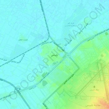
Name: Bilbeis topographic map, elevation, terrain.
Location: Bilbeis, Eastern, 44621, Egypt (30.37876 31.52463 30.45876 31.60463)
Average elevation: 49 ft
Minimum elevation: 26 ft
Maximum elevation: 151 ft
Other topographic maps
Click on a map to view its topography, its elevation and its terrain.
Manshiyat al Sawamah
Manshiyat al Sawamah, Eastern, 44768, Egypt
Average elevation: 20 ft
Abu Hammad al Mahattah
Abu Hammad al Mahattah, Eastern, 44661, Egypt
Average elevation: 30 ft