Geolocate

Abu Hammad al Mahattah topographic map

Interactive map

Click on the map to display elevation.

About this map

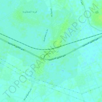
Name: Abu Hammad al Mahattah topographic map, elevation, terrain.

Location: Abu Hammad al Mahattah, Eastern, 44661, Egypt (30.51541 31.65695 30.55541 31.69695)

Average elevation: 30 ft

Minimum elevation: 16 ft

Maximum elevation: 46 ft

Other topographic maps

Click on a map to view its topography, its elevation and its terrain.

Abou Kebir City

Egypt > Eastern

Abou Kebir City, Eastern, 44671, Egypt

Average elevation: 23 ft

Hihya City

Egypt > Eastern

Hihya City, Eastern, 44741, Egypt

Average elevation: 26 ft

Manshiyat al Sawamah

Egypt > Eastern

Manshiyat al Sawamah, Eastern, 44768, Egypt

Average elevation: 20 ft

10th of Ramadan

Egypt > Eastern

10th of Ramadan, Eastern, Egypt

Average elevation: 341 ft

Mashtul Al-Suq

Egypt > Eastern

Mashtul Al-Suq, Eastern, 44611, Egypt

Average elevation: 43 ft

Banayus

Egypt > Eastern

Banayus, Eastern, 44819, Egypt

Average elevation: 33 ft

Bilbeis

Egypt > Eastern

Bilbeis, Eastern, 44621, Egypt

Average elevation: 49 ft

Al Zaqaziq

Egypt > Eastern

Al Zaqaziq, Eastern, 44512, Egypt

Average elevation: 30 ft