
孟连县 topographic map
Interactive map
Click on the map to display elevation.
About this map
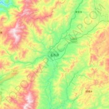
Name: 孟连县 topographic map, elevation, terrain.
Location: 孟连县, 孟连傣族拉祜族佤族自治县, 普洱市, 云南省, 665000, 中国 (22.16878 99.43172 22.48878 99.75172)
Average elevation: 4,344 ft
Minimum elevation: 2,388 ft
Maximum elevation: 7,326 ft
Other topographic maps
Click on a map to view its topography, its elevation and its terrain.