
勐阿 topographic map
Interactive map
Click on the map to display elevation.
About this map
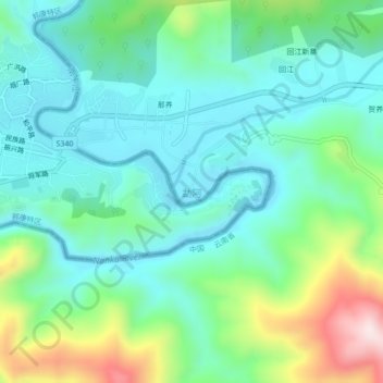
Name: 勐阿 topographic map, elevation, terrain.
Location: 勐阿, 孟连傣族拉祜族佤族自治县, 普洱市, 云南省, 中国 (22.15274 99.17154 22.19274 99.21154)
Average elevation: 1,978 ft
Minimum elevation: 1,591 ft
Maximum elevation: 3,094 ft
Other topographic maps
Click on a map to view its topography, its elevation and its terrain.