Geolocate

Hightower topographic map

Click on the map to display elevation.

About this map

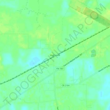
Name: Hightower topographic map, elevation, terrain.

Location: Hightower, Liberty County, Texas, United States (30.37160 -94.99215 30.41160 -94.95215)

Average elevation: 161 ft

Minimum elevation: 135 ft

Maximum elevation: 184 ft

Liberty County trails, hiking, mountain biking, running and outdoor activities

Other topographic maps

Click on a map to view its topography, its elevation and its terrain.

Dayton

United States > Texas > Liberty County

Average elevation: 52 ft

Kenefick

United States > Texas > Liberty County

Average elevation: 56 ft

Daisetta

United States > Texas > Liberty County

Average elevation: 69 ft

Cleveland

United States > Texas > Liberty County

Average elevation: 154 ft

Plum Grove

United States > Texas > Liberty County

Average elevation: 102 ft

Dayton

United States > Texas > Liberty County

Average elevation: 52 ft

Gear up for your next adventure:

🏔️Mountain Trail Maps - High‑detail maps for popular peaks
📶Satellite Messenger - Communication device off‑grid
🧭Map Reading Tools - Tools and kits for map navigation
💧Water Purification System - Clean water on the trail with reliable purifiers
🧣Hiking Neck Gaiter - Multi‑use neck protection for outdoor weather

As an Amazon Associate, this site earns from qualifying purchases at no extra cost to you.