
Beaver Town topographic map
Click on the map to display elevation.
About this map
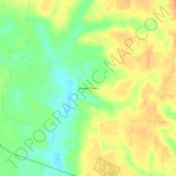
Name: Beaver Town topographic map, elevation, terrain.
Location: Beaver Town, Pickens County, Alabama, United States (33.17457 -88.21809 33.21457 -88.17809)
Average elevation: 256 ft
Minimum elevation: 177 ft
Maximum elevation: 325 ft
Pickens County trails, hiking, mountain biking, running and outdoor activities
Other topographic maps
Click on a map to view its topography, its elevation and its terrain.