
Somerset topographic map
Click on the map to display elevation.
About this map
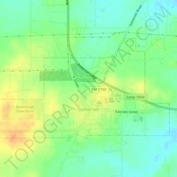
Name: Somerset topographic map, elevation, terrain.
Location: Somerset, Bexar County, Texas, United States (29.22034 -98.68023 29.24084 -98.63881)
Average elevation: 630 ft
Minimum elevation: 577 ft
Maximum elevation: 696 ft
Bexar County trails, hiking, mountain biking, running and outdoor activities
Other topographic maps
Click on a map to view its topography, its elevation and its terrain.