Geolocate

西沟村 topographic map

Interactive map

Click on the map to display elevation.

About this map

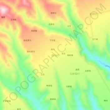
Name: 西沟村 topographic map, elevation, terrain.

Location: 西沟村, 平陆县, 运城市, 山西省, 中国 (34.84309 111.01749 34.88309 111.05749)

Average elevation: 2,392 ft

Minimum elevation: 1,706 ft

Maximum elevation: 3,136 ft

Other topographic maps

Click on a map to view its topography, its elevation and its terrain.

龙源村

中国 > 山西省 > 平陆县

龙源村, 平陆县, 运城市, 山西省, 中国

Average elevation: 2,493 ft

常乐镇

中国 > 山西省 > 平陆县

常乐镇, 平陆县, 运城市, 山西省, 中国

Average elevation: 1,667 ft

中条山

中国 > 山西省 > 平陆县

中条山, 平陆县, 运城市, 山西省, 044400, 中国

Average elevation: 2,195 ft

后滩村

中国 > 山西省 > 平陆县 > 后滩村

后滩村, 平陆县, 运城市, 山西省, 中国

Average elevation: 2,428 ft

平陆县

中国 > 山西省 > 平陆县

平陆县, 运城市, 山西省, 中国

Average elevation: 2,037 ft

曹川镇

中国 > 山西省 > 平陆县 > 曹川镇

曹川镇, 平陆县, 运城市, 山西省, 中国

Average elevation: 1,798 ft

河南

中国 > 山西省 > 平陆县 > 下涧村 > 后沟

河南, 后沟, 下涧村, 平陆县, 运城市, 山西省, 中国

Average elevation: 2,096 ft