Geolocate

Laird topographic map

Click on the map to display elevation.

👉 Easily get elevation data in JSON, GeoTIFF and KML formats using Elevation API
Thank you for supporting this site ❤️
Make a donation

About this map

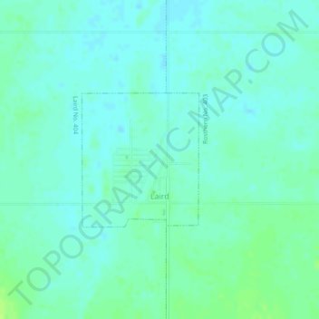
Name: Laird topographic map, elevation, terrain.

Location: Laird, Division No. 15, Saskatchewan, S0K 2H0, Canada (52.70918 -106.59724 52.72053 -106.58089)

Average elevation: 1,732 ft

Minimum elevation: 1,716 ft

Maximum elevation: 1,755 ft

Other topographic maps

Click on a map to view its topography, its elevation and its terrain.

Humboldt

Canada > Saskatchewan > Division No. 15

Average elevation: 1,857 ft

Carmel

Canada > Saskatchewan > Division No. 15 > Humboldt No. 370

Average elevation: 1,880 ft

Wingard

Canada > Saskatchewan > Division No. 15

Average elevation: 1,647 ft

Batoche

Canada > Saskatchewan > Division No. 15

Average elevation: 1,555 ft

Gear up for your next adventure:

📦Dry Bags Set - Waterproof storage for electronics and clothes
📚Navigation Handbooks - Master the art of reading topographic maps and using a compass
🦶Hiking Gaiters - Keep debris and water out of your boots
🛏️Cold Weather Sleeping Bag - Warm sleeping bag for cold conditions
🗃️Trail First Aid Kit - Essential kit for outdoor injuries and emergencies

As an Amazon Associate, this site earns from qualifying purchases at no extra cost to you.