
Make a donation
Gear up for your next adventure:
As an Amazon Associate, this site earns from qualifying purchases at no extra cost to you.
Ahtanum topographic map
Click on the map to display elevation.
Make a donation
Gear up for your next adventure:
As an Amazon Associate, this site earns from qualifying purchases at no extra cost to you.
About this map
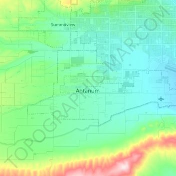
Name: Ahtanum topographic map, elevation, terrain.
Location: Ahtanum, Yakima County, Washington, United States (46.54004 -120.67102 46.58217 -120.52827)
Average elevation: 1,391 ft
Minimum elevation: 1,076 ft
Maximum elevation: 2,490 ft
Yakima County trails, hiking, mountain biking, running and outdoor activities
Make a donation
Gear up for your next adventure:
As an Amazon Associate, this site earns from qualifying purchases at no extra cost to you.
Other topographic maps
Click on a map to view its topography, its elevation and its terrain.
Sunnyside
United States > Washington > Yakima County > Sunnyside > Sunnyside
Average elevation: 784 ft
Make a donation
Gear up for your next adventure:
As an Amazon Associate, this site earns from qualifying purchases at no extra cost to you.