
Make a donation
Gear up for your next adventure:
As an Amazon Associate, this site earns from qualifying purchases at no extra cost to you.
Holte-Lastrup topographic map
Click on the map to display elevation.
Make a donation
Gear up for your next adventure:
As an Amazon Associate, this site earns from qualifying purchases at no extra cost to you.
About this map
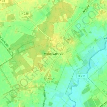
Name: Holte-Lastrup topographic map, elevation, terrain.
Average elevation: 95 ft
Minimum elevation: 62 ft
Maximum elevation: 125 ft
Make a donation
Gear up for your next adventure:
As an Amazon Associate, this site earns from qualifying purchases at no extra cost to you.
Other topographic maps
Click on a map to view its topography, its elevation and its terrain.
Lünne
Deutschland > Niedersachsen > Landkreis Emsland
Plantlünne wurde 1276 als Pfarrei benannt und soll sich von Altenlünne abgezweigt haben. Das Bestimmungswort ist nicht gesichert. Nach L. Schriever liegt die Herleitung von niederdeutsch planten = pflanzen (neu gründen) nahe. Auf der Anhöhe, wo heute die St.-Vitus-Kirche steht, soll ein alter Turm…
Average elevation: 112 ft
Make a donation
Gear up for your next adventure:
As an Amazon Associate, this site earns from qualifying purchases at no extra cost to you.
Andervenne
Deutschland > Niedersachsen > Landkreis Emsland
Die Gemeinde Andervenne liegt an der B 214 zwischen Freren und Fürstenau und etwa 20 km östlich der Ems und der Stadt Lingen auf der Südseite der Lingener Höhe. Auf dem Gebiet der Gemeinde Andervenne liegt das Südostufer des Saller Sees.
Average elevation: 144 ft
Herzlake
Deutschland > Niedersachsen > Landkreis Emsland
Herzlake liegt nur etwas nordwestlich der Ankumer Höhe am Fluss Hase, zwischen Haselünne und Löningen. Östlich des Orts endet das Hase-Binnendelta mit der Vereinigung der Großen Hase und des Hahnenmoorkanals als Verlängerung der Kleinen Hase; westlich von ihm mündet die Südradde in die Hase.
Average elevation: 82 ft
Make a donation
Gear up for your next adventure:
As an Amazon Associate, this site earns from qualifying purchases at no extra cost to you.
Freren
Deutschland > Niedersachsen > Landkreis Emsland
Freren liegt im Landkreis Emsland nahe der südlich verlaufenden Landesgrenze zu Nordrhein-Westfalen, südöstlich der Lingener Höhe und direkt an der B 214.
Average elevation: 135 ft
Sögel
Deutschland > Niedersachsen > Landkreis Emsland
In dem Ort steht auch die erste rumänisch-orthodoxe Kirche Niedersachsens (und die vierte in Deutschland). Die Kirche ist komplett aus Holz gebaut. Sie wurde im Frühjahr 2021 fertiggestellt und bietet Platz für ca. 200 Gläubige. Das Bauwerk beeindruckt mit knapp 32 Metern Höhe und 24 Metern Länge,…
Average elevation: 121 ft
Make a donation
Gear up for your next adventure:
As an Amazon Associate, this site earns from qualifying purchases at no extra cost to you.
Salzbergen
Deutschland > Niedersachsen > Landkreis Emsland
Das 1993 eröffnete Feuerwehrmuseum Salzbergen zeigt Feuerwehrexponate aus aller Welt. Der Feuerwehrmuseumsverein verfügt über eine Anzahl von Fahrzeugen, Handdruckspritzen, Geräten und Kleinteilen. Unter anderem sind Helme aus aller Welt, Kappen und Mützen, Uniformen, Ärmelabzeichen, Orden und…
Average elevation: 128 ft
Lingen (Ems)
Deutschland > Niedersachsen > Landkreis Emsland
Lingen liegt im südlichen Teil des sich hauptsächlich in Nord-Süd-Richtung ausdehnenden Emslands. Ostsüdöstlich von Lingen, das überwiegend am östlichen Ufer der Ems liegt, befindet sich die Lingener Höhe.
Average elevation: 95 ft
Make a donation
Gear up for your next adventure:
As an Amazon Associate, this site earns from qualifying purchases at no extra cost to you.
Lorup
Deutschland > Niedersachsen > Landkreis Emsland
Die Gemeinde Lorup liegt im nordöstlichen Teil des Hümmling, einer bis zu 73 Meter über NHN hohen waldreichen Geestlandschaft im Emsland. Höchste Erhebung in der Gemarkung des Dorfes ist mit 42 Meter über NHN die Buschhöhe. Rund 18 Kilometer nordöstlich liegt die Stadt Friesoythe.
Average elevation: 72 ft
Make a donation
Gear up for your next adventure:
As an Amazon Associate, this site earns from qualifying purchases at no extra cost to you.
Make a donation
Gear up for your next adventure:
As an Amazon Associate, this site earns from qualifying purchases at no extra cost to you.
Niederlangen
Deutschland > Niedersachsen > Landkreis Emsland
Das Wappen verdeutlicht geographisch-topographische und historische Elemente der Gemeinde Niederlangen. Die Wellen im Schildfuss symbolisieren die Lage an der Ems und den Wasserreichtum mit den auf Teiche reduzierten Altwässern und den Moorabzugsgräben. Ähre und Rohrkolben zeigen an, dass Niederlangen…
Average elevation: 36 ft
Werpeloh
Deutschland > Niedersachsen > Landkreis Emsland
In Werpeloh gibt es den Sportverein Werpeloh e.V. Hier wird vor allem Fußball angeboten – von Minikicker bis Alte Herren. Die 1. Herrenmannschaft spielt derzeit in der 2. Kreisklasse Emsland Nord, in welche sie in der Saison 2015/16 nach einem Jahr in der nächsthöheren 1. Kreisklasse Emsland Nord…
Average elevation: 115 ft
Make a donation
Gear up for your next adventure:
As an Amazon Associate, this site earns from qualifying purchases at no extra cost to you.
Lähden
Deutschland > Niedersachsen > Landkreis Emsland
Am 1. Februar 1971 kam es zur Eingliederung der Gemeinden Holte-Lastrup, Ahmsen, Herßum und Vinnen in die Gemeinde Lähden. Zuvor gab es einen erbitterten Kampf um den Schulstandort, den Namen und den Sitz der Gemeinde. Der Schulzweckverband setzte sich für Holte-Lastrup als geschichtlich gewachsener…
Average elevation: 92 ft
Surwold
Deutschland > Niedersachsen > Landkreis Emsland
Der südlich gelegene Ortsteil Börgerwald mit rd. 1.800 Einwohnern liegt am nördlichen Rande des hügeligen und waldreichen Hümmlings, 5–42 Meter über dem Meeresspiegel. Die Nutzung der Landschaft ist durch die Landwirtschaft geprägt. Bemerkenswert ist die „Serpentine“ der L51 im Bereich der…
Average elevation: 36 ft
Beesten
Deutschland > Niedersachsen > Landkreis Emsland
Aus Beesten kamen auch einige Tödden. Die Tödden waren Wanderkaufleute und Hausierer, die sich nach dem Dreißigjährigen Krieg, mit der Blütezeit im 18. Jahrhundert, aus Hollandgängern entwickelten und ihre Waren zunächst in den Niederlanden, später auch in den nordischen und baltischen Ländern…
Average elevation: 112 ft
Make a donation
Gear up for your next adventure:
As an Amazon Associate, this site earns from qualifying purchases at no extra cost to you.
Renkenberge
Deutschland > Niedersachsen > Landkreis Emsland
Die Gemeinde entstand ab 1932 im Rahmen der Emslandkultivierung aus den Neusiedlungen Kluse und Melstrup-Siedlung und wurde 1934 zu einer selbständigen Gemeinde erklärt, die zunächst den Namen Kluse trug. Mit Wirkung zum 1. Oktober 1938 erhielt die Gemeinde Kluse den neuen Namen Renkenberge, um den…
Average elevation: 46 ft
Make a donation
Gear up for your next adventure:
As an Amazon Associate, this site earns from qualifying purchases at no extra cost to you.
Thuine
Deutschland > Niedersachsen > Landkreis Emsland
Thuine liegt an der Bundesstraße 214, etwa 12 km östlich der Stadt Lingen (Ems) und 50 Kilometer nordwestlich von Osnabrück. Es liegt im Mittelteil der hügeligen und waldreichen Lingener Höhe (ein Teil davon heißt Thuiner Holz), dessen höchste Erhebung mit 91 m über NN der Windmühlenberg an der Grenze…
Average elevation: 164 ft
Oberlangen
Deutschland > Niedersachsen > Landkreis Emsland
Schützenfest, immer Christi Himmelfahrt, gefeiert wird Donnerstag und Freitag. Das Schützenfest ist der Höhepunkt eines jeden Jahres und ist auch weit über Oberlangen hinaus bekannt. Am ersten Tag marschieren alle Schützen vom Heimathaus Oberlangen zum Schützenplatz. Der zweite Schützenfesttag beginnt…
Average elevation: 43 ft
Make a donation
Gear up for your next adventure:
As an Amazon Associate, this site earns from qualifying purchases at no extra cost to you.
Make a donation
Gear up for your next adventure:
As an Amazon Associate, this site earns from qualifying purchases at no extra cost to you.
Langen
Deutschland > Niedersachsen > Landkreis Emsland
Langen liegt am Nordrand der Lingener Höhe etwa zehn Kilometer östlich der Ems und der Stadt Lingen.
Average elevation: 131 ft
Make a donation
Gear up for your next adventure:
As an Amazon Associate, this site earns from qualifying purchases at no extra cost to you.
Make a donation
Gear up for your next adventure:
As an Amazon Associate, this site earns from qualifying purchases at no extra cost to you.
Make a donation
Gear up for your next adventure:
As an Amazon Associate, this site earns from qualifying purchases at no extra cost to you.
Teglingen
Deutschland > Niedersachsen > Landkreis Emsland > Meppen
In den 1950er Jahren wurde der Dortmund-Ems-Kanal ausgebaut. Bei Teglingen wurde eine neue Schleusengruppe gebaut (zwei Schleusen von 165 m und 100 m Nutzlänge; Fallhöhe 7,5 m), damit die alte Kanalstufe Meppen entfallen konnte.
Average elevation: 56 ft
Make a donation
Gear up for your next adventure:
As an Amazon Associate, this site earns from qualifying purchases at no extra cost to you.
Bawinkel
Deutschland > Niedersachsen > Landkreis Emsland
Archäologische Funde belegen eine Besiedlung des Raumes Bawinkel in frühgermanischer Zeit. So konnten bei Kultivierungsarbeiten auf dem etwas höher gelegenen Gelände des Ortsteils Duisenburg, Urnen und Scherben aus vorchristlicher Zeit geborgen werden.
Average elevation: 75 ft
Make a donation
Gear up for your next adventure:
As an Amazon Associate, this site earns from qualifying purchases at no extra cost to you.
Make a donation
Gear up for your next adventure:
As an Amazon Associate, this site earns from qualifying purchases at no extra cost to you.
Schloss Dankern
Deutschland > Niedersachsen > Landkreis Emsland > Haren (Ems) > Altharen > Dankern
Average elevation: 39 ft
Make a donation
Gear up for your next adventure:
As an Amazon Associate, this site earns from qualifying purchases at no extra cost to you.
Geeste
Deutschland > Niedersachsen > Landkreis Emsland
Geeste liegt im Emsland zwischen Meppen im Norden und Lingen im Süden. Unmittelbar südöstlich der Gemeinde liegt das Speicherbecken Geeste, und etwas weiter in dieser Richtung liegt die Lingener Höhe.
Average elevation: 69 ft
Make a donation
Gear up for your next adventure:
As an Amazon Associate, this site earns from qualifying purchases at no extra cost to you.
Lengerich
Deutschland > Niedersachsen > Landkreis Emsland
Lengerich liegt am Nordostrand der Lingener Höhe etwa 15 km östlich der Ems und der Stadt Lingen.
Average elevation: 108 ft
Dankernsee
Deutschland > Niedersachsen > Landkreis Emsland > Haren (Ems) > Dankern
Average elevation: 43 ft
Twist
Deutschland > Niedersachsen > Landkreis Emsland
1926 wurde ein Kirchenbauverein gegründet, um die 1903 als Notkirche geweihte Baracke auf dem Grundstück des heutigen Pfarrhauses in Schöninghsdorf zu ersetzen. Die St.-Franziskus-Kirche wurde nach Plänen des Architekten Theo Burlage im Stil des Expressionismus gebaut. Beginn der Bauarbeiten für die neue…
Average elevation: 59 ft
Make a donation
Gear up for your next adventure:
As an Amazon Associate, this site earns from qualifying purchases at no extra cost to you.
Lingen (Ems)
Deutschland > Niedersachsen > Landkreis Emsland
Lingen liegt im südlichen Teil des sich hauptsächlich in Nord-Süd-Richtung ausdehnenden Emslands. Ostsüdöstlich von Lingen, das überwiegend am östlichen Ufer der Ems liegt, befindet sich die Lingener Höhe.
Average elevation: 95 ft
49811
Deutschland > Niedersachsen > Landkreis Emsland > Lingen (Ems) > Baccum > Övernhoff
Average elevation: 108 ft
Make a donation
Gear up for your next adventure:
As an Amazon Associate, this site earns from qualifying purchases at no extra cost to you.
Aschendorfer Moor
Deutschland > Niedersachsen > Landkreis Emsland > Papenburg
Average elevation: 26 ft
Make a donation
Gear up for your next adventure:
As an Amazon Associate, this site earns from qualifying purchases at no extra cost to you.
Make a donation
Gear up for your next adventure:
As an Amazon Associate, this site earns from qualifying purchases at no extra cost to you.