
Sundridge topographic map
Click on the map to display elevation.
About this map
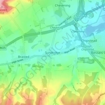
Name: Sundridge topographic map, elevation, terrain.
Location: Sundridge, Sevenoaks, Kent, England, TN14 6ES, United Kingdom (51.25926 0.10857 51.29926 0.14857)
Average elevation: 381 ft
Minimum elevation: 233 ft
Maximum elevation: 725 ft
Other topographic maps
Click on a map to view its topography, its elevation and its terrain.
Sevenoaks Weald
United Kingdom > England > Kent > Sevenoaks > Sevenoaks Weald
Average elevation: 367 ft