
Make a donation
Gear up for your next adventure:
As an Amazon Associate, this site earns from qualifying purchases at no extra cost to you.
Heritage topographic map
Click on the map to display elevation.
Make a donation
Gear up for your next adventure:
As an Amazon Associate, this site earns from qualifying purchases at no extra cost to you.
About this map
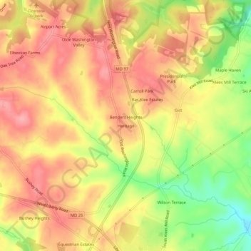
Name: Heritage topographic map, elevation, terrain.
Location: Heritage, Carroll County, Maryland, United States (39.42816 -77.02054 39.46816 -76.98054)
Average elevation: 702 ft
Minimum elevation: 486 ft
Maximum elevation: 833 ft
Carroll County trails, hiking, mountain biking, running and outdoor activities
Make a donation
Gear up for your next adventure:
As an Amazon Associate, this site earns from qualifying purchases at no extra cost to you.
Other topographic maps
Click on a map to view its topography, its elevation and its terrain.
Avondale Wildlife Management Area
United States > Maryland > Carroll County > Chapel Heights
Average elevation: 676 ft
Make a donation
Gear up for your next adventure:
As an Amazon Associate, this site earns from qualifying purchases at no extra cost to you.