Geolocate

Aerial topographic map

Click on the map to display elevation.

About this map

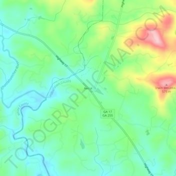
Name: Aerial topographic map, elevation, terrain.

Location: Aerial, Habersham County, Georgia, 30571, United States (34.64454 -83.66434 34.68454 -83.62434)

Average elevation: 1,476 ft

Minimum elevation: 1,280 ft

Maximum elevation: 1,913 ft

Habersham County trails, hiking, mountain biking, running and outdoor activities

Other topographic maps

Click on a map to view its topography, its elevation and its terrain.

Clarkesville

United States > Georgia > Habersham County

Average elevation: 1,371 ft

Cornelia

United States > Georgia > Habersham County

Average elevation: 1,463 ft

Mount Airy

United States > Georgia > Habersham County

Average elevation: 1,453 ft

Tallulah Falls

United States > Georgia > Habersham County

Average elevation: 1,601 ft

Cornelia

United States > Georgia > Habersham County

Average elevation: 1,463 ft

Clarkesville

United States > Georgia > Habersham County

Average elevation: 1,371 ft

Tallulah Falls

United States > Georgia > Habersham County

Average elevation: 1,601 ft

Baldwin

United States > Georgia > Habersham County

Average elevation: 1,296 ft

Gear up for your next adventure:

🔌Solar Panel Charger - Charge gear sustainably outdoors
🧣Merino Neck Gaiters - Multi-functional headwear for wind and sun protection
🪶Fire Starter Kit - Reliable fire starter for survival and camping
🚗GPS Dash Cams - Record your scenic drives through mountain passes and canyons
📖Nature Tracking Books - Learn to track wildlife and terrain

As an Amazon Associate, this site earns from qualifying purchases at no extra cost to you.