Geolocate

Climax topographic map

Click on the map to display elevation.

Climax

Climax was founded in 1884. It was named from its elevation, or Climax College in Kalamazoo, Michigan.

Wikipedia (CC-BY-SA 3.0)

About this map

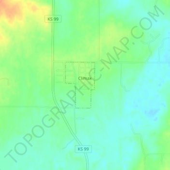
Name: Climax topographic map, elevation, terrain.

Location: Climax, Greenwood County, Kansas, United States (37.71497 -96.22728 37.72230 -96.22137)

Average elevation: 1,027 ft

Minimum elevation: 981 ft

Maximum elevation: 1,112 ft

Greenwood County trails, hiking, mountain biking, running and outdoor activities

Other topographic maps

Click on a map to view its topography, its elevation and its terrain.

Neal

United States > Kansas > Greenwood County

Average elevation: 1,001 ft

Piedmont

United States > Kansas > Greenwood County

Average elevation: 1,230 ft

Quincy

United States > Kansas > Greenwood County > Quincy

Average elevation: 965 ft

Gear up for your next adventure:

🛰️Satellite Messengers - Emergency SOS and two-way messaging for off-grid adventures
🧭Map Reading Tools - Tools and kits for map navigation
🔥Plasma Lighters - Windproof lighters that work in any weather condition
🔭Telescopic Hiking Pole - Adjustable pole for hiking stability
🚪Portable Camp Chair - Foldable chair for comfort at camp

As an Amazon Associate, this site earns from qualifying purchases at no extra cost to you.