Geolocate

Buttsville topographic map

Click on the map to display elevation.

About this map

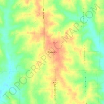
Name: Buttsville topographic map, elevation, terrain.

Location: Buttsville, Grundy County, Missouri, United States (40.19279 -93.69133 40.23279 -93.65133)

Average elevation: 873 ft

Minimum elevation: 787 ft

Maximum elevation: 951 ft

Grundy County trails, hiking, mountain biking, running and outdoor activities

Other topographic maps

Click on a map to view its topography, its elevation and its terrain.

Galt

United States > Missouri > Grundy County

Average elevation: 830 ft

Laredo

United States > Missouri > Grundy County

Average elevation: 801 ft

Tindall

United States > Missouri > Grundy County

Average elevation: 814 ft

Brimson

United States > Missouri > Grundy County

Average elevation: 797 ft

Gear up for your next adventure:

📚USA Hiking Guide Books - Top trail guides and map books
🪶Multi‑Purpose Knife - Useful blade for camp and trail
🪶Paracord Bracelet - Survival bracelet with built‑in tools
🧢Outdoor Hiking Hat - Sun protection hat for outdoor explorers
🛰️Satellite Messengers - Emergency SOS and two-way messaging for off-grid adventures

As an Amazon Associate, this site earns from qualifying purchases at no extra cost to you.