
Grey Forest topographic map
Click on the map to display elevation.
About this map
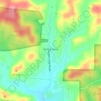
Name: Grey Forest topographic map, elevation, terrain.
Location: Grey Forest, Bexar County, Texas, United States (29.60707 -98.69177 29.62720 -98.67750)
Average elevation: 1,234 ft
Minimum elevation: 1,086 ft
Maximum elevation: 1,437 ft
Bexar County trails, hiking, mountain biking, running and outdoor activities
Other topographic maps
Click on a map to view its topography, its elevation and its terrain.