
卡龙乡 topographic map
Interactive map
Click on the map to display elevation.
About this map
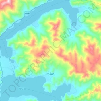
Name: 卡龙乡 topographic map, elevation, terrain.
Location: 卡龙乡, 浪卡子县, 山南市, 西藏自治区, 中国 (28.99328 90.39843 29.14976 90.57884)
Average elevation: 15,325 ft
Minimum elevation: 14,557 ft
Maximum elevation: 17,897 ft
Other topographic maps
Click on a map to view its topography, its elevation and its terrain.