Geolocate

El Rabwa topographic map

Click on the map to display elevation.

About this map

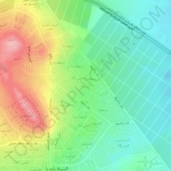
Name: El Rabwa topographic map, elevation, terrain.

Location: El Rabwa, Giza, 12593, Egypt (30.04455 30.96713 30.08455 31.00713)

Average elevation: 436 ft

Minimum elevation: 256 ft

Maximum elevation: 735 ft

Other topographic maps

Click on a map to view its topography, its elevation and its terrain.

Giza Pyramids

Egypt > Giza > Giza

Average elevation: 213 ft

Giza Pyramids

Egypt > Giza > Giza

Average elevation: 213 ft

Giza Pyramids

Egypt > Giza > Giza

Average elevation: 213 ft

Al Haraneya Village

Egypt > Giza

Average elevation: 62 ft

Abo Al Nomros City

Egypt > Giza > Abu An Numrus

Average elevation: 66 ft

Ard Al Lwaa'

Egypt > Giza > Nazlet Bahgat

Average elevation: 75 ft

Kerdasa City

Egypt > Giza > Kirdasah

Average elevation: 92 ft

City View

Egypt > Giza

Average elevation: 213 ft

Al Mounib

Egypt > Giza

Average elevation: 72 ft

Jazirat Warraq al Hadar

Egypt > Giza > Tanaash

Average elevation: 66 ft

Ard Al Lwaa'

Egypt > Giza > Nazlet Bahgat

Average elevation: 75 ft

Gezirat Dahab

Egypt > Giza

Average elevation: 69 ft

Sheikh Zayed

Egypt > Giza

Average elevation: 400 ft

Nazlet Al Siman and Al Sisi

Egypt > Giza > Remaya Square

Average elevation: 138 ft

Abu Sir

Egypt > Giza > Abu Sir

Average elevation: 144 ft

Qursaya

Egypt > Giza > Giza

Average elevation: 75 ft

El Hassana Dome Protectorate

Egypt > Giza > Sheikh Zayed

Average elevation: 354 ft

Al Hosary park

Egypt > Giza > Sixth of October

Average elevation: 604 ft

Gear up for your next adventure:

🩹Survival Bandages - High‑quality bandages for emergencies
🪶Trail Camera - Capture wildlife on your hikes
🕶️GPS Smartphone Mount - Secure mount for phone navigation
🛶Inflatable Kayak - Portable kayak for rivers, lakes, and expeditions
🛰️Handheld GPS Units - Professional satellite navigators for precise backcountry mapping

As an Amazon Associate, this site earns from qualifying purchases at no extra cost to you.