Geolocate

Bell topographic map

Interactive map

Click on the map to display elevation.

About this map

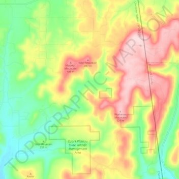
Name: Bell topographic map, elevation, terrain.

Location: Bell, Adair County, Oklahoma, United States (35.69709 -94.58297 35.79252 -94.48279)

Average elevation: 1,240 ft

Minimum elevation: 791 ft

Maximum elevation: 1,765 ft

Other topographic maps

Click on a map to view its topography, its elevation and its terrain.

Westville

United States > Oklahoma > Adair County

Westville, Adair County, Oklahoma, 74965, United States

Average elevation: 1,138 ft

Watts

United States > Oklahoma > Adair County

Watts, Adair County, Oklahoma, United States

Average elevation: 1,030 ft

Bunch

United States > Oklahoma > Adair County

Bunch, Adair County, Oklahoma, United States

Average elevation: 935 ft

Baron

United States > Oklahoma > Adair County

Baron, Adair County, Oklahoma, United States

Average elevation: 971 ft

Stilwell

United States > Oklahoma > Adair County

Stilwell, Adair County, Oklahoma, 74960, United States

Average elevation: 1,155 ft