Geolocate

Bunch topographic map

Click on the map to display elevation.

About this map

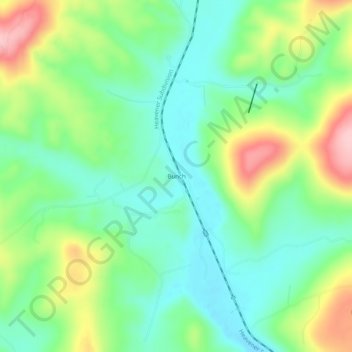
Name: Bunch topographic map, elevation, terrain.

Location: Bunch, Adair County, Oklahoma, United States (35.66259 -94.78106 35.70259 -94.74106)

Average elevation: 935 ft

Minimum elevation: 728 ft

Maximum elevation: 1,339 ft

Adair County trails, hiking, mountain biking, running and outdoor activities

Other topographic maps

Click on a map to view its topography, its elevation and its terrain.

Watts

United States > Oklahoma > Adair County

Average elevation: 1,030 ft

Bell

United States > Oklahoma > Adair County

Average elevation: 1,240 ft

Westville

United States > Oklahoma > Adair County

Average elevation: 1,138 ft

Gear up for your next adventure:

🌡️Portable Weather Meter - Track weather conditions on the trail
📷Action Camera - Capture your outdoor adventures in HD
🎒Waterproof Dry Bags - Keep your electronics and maps dry inside your pack
🏔️Mountain Trail Maps - High‑detail maps for popular peaks
🔥Plasma Lighters - Windproof lighters that work in any weather condition

As an Amazon Associate, this site earns from qualifying purchases at no extra cost to you.