
Wadley topographic map
Click on the map to display elevation.
About this map
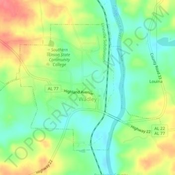
Name: Wadley topographic map, elevation, terrain.
Location: Wadley, Randolph County, Alabama, United States (33.11254 -85.58702 33.13447 -85.55076)
Average elevation: 692 ft
Minimum elevation: 600 ft
Maximum elevation: 814 ft
Randolph County trails, hiking, mountain biking, running and outdoor activities
Other topographic maps
Click on a map to view its topography, its elevation and its terrain.