Geolocate

Kharmang topographic map

Click on the map to display elevation.

About this map

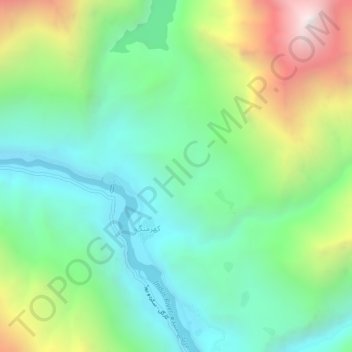
Name: Kharmang topographic map, elevation, terrain.

Location: Kharmang, Gilgit-Baltistan, Pakistan (34.94868 76.19385 34.98868 76.23385)

Average elevation: 9,905 ft

Minimum elevation: 8,005 ft

Maximum elevation: 13,993 ft

Other topographic maps

Click on a map to view its topography, its elevation and its terrain.

Hunza District

Pakistan > Gilgit-Baltistan

Average elevation: 14,797 ft

Astore Tehsil

Pakistan > Gilgit-Baltistan > Astore District

Average elevation: 12,454 ft

Astore District

Pakistan > Gilgit-Baltistan

Average elevation: 12,231 ft

Hunza River

Pakistan > Gilgit-Baltistan > Minapin Nagar

Average elevation: 8,855 ft

Shigar River

Pakistan > Gilgit-Baltistan > Skardu

Average elevation: 9,465 ft

Gear up for your next adventure:

🔥Fast-Boil Camping Stoves - Efficient cooking systems for quick trail meals
🎒Day Hiking Backpack - Lightweight backpack perfect for day trips and outdoor adventures
🧤Tactile Hiking Gloves - Keep hands warm while operating GPS and smartphone screens
🧭Orienteering Set - Complete compass and map reading kit
🔌USB Car Charger - Car charger for on‑the‑go power needs

As an Amazon Associate, this site earns from qualifying purchases at no extra cost to you.