
Gweru topographic map
Interactive map
Click on the map to display elevation.
About this map
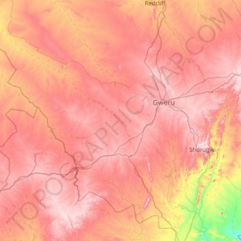
Name: Gweru topographic map, elevation, terrain.
Location: Gweru, Midlands, Zimbabwe (-19.99125 29.09365 -19.08981 30.21307)
Average elevation: 4,259 ft
Minimum elevation: 3,084 ft
Maximum elevation: 5,108 ft
Other topographic maps
Click on a map to view its topography, its elevation and its terrain.
Sengwa River
Sengwa River, Gokwe North, Midlands, Zimbabwe
Average elevation: 2,615 ft
Sidakeni Business Center
Zimbabwe > Midlands > Sidakeni Business Center
Sidakeni Business Center, Kwekwe, Midlands, Zimbabwe
Average elevation: 3,360 ft