Geolocate

Inner Kartli topographic map

Click on the map to display elevation.

About this map

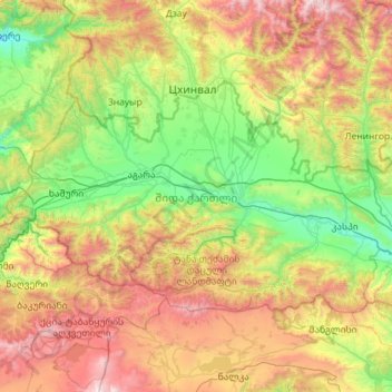
Name: Inner Kartli topographic map, elevation, terrain.

Location: Inner Kartli, Georgia (41.73517 43.42262 42.24239 44.57391)

Average elevation: 4,298 ft

Minimum elevation: 1,430 ft

Maximum elevation: 10,440 ft

Other topographic maps

Click on a map to view its topography, its elevation and its terrain.

Khashuri

Georgia > Inner Kartli > Khashuri Municipality

Average elevation: 2,329 ft

Sasireti

Georgia > Inner Kartli > Kaspi Municipality

Average elevation: 1,844 ft

Metekhis Sadguri

Georgia > Inner Kartli > Kaspi Municipality

Average elevation: 1,827 ft

Gear up for your next adventure:

💧Water Filtration Bottles - Safely drink from streams and lakes while exploring
Backpacking Tent - Lightweight and durable tent for multi‑day hikes
🌧️Backpack Rain Cover - Keep gear dry in wet weather
GPS Sports Watch - GPS watch for running, hiking and training
📖Nature Tracking Books - Learn to track wildlife and terrain

As an Amazon Associate, this site earns from qualifying purchases at no extra cost to you.