Geolocate

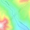
Songhangra topographic map

Click on the map to display elevation.

About this map

Name: Songhangra topographic map, elevation, terrain.

Location: Songhangra, Joshimath Tehsil, Chamoli, Uttarakhand, 246443, India (30.54493 79.65958 30.54503 79.65968)

Average elevation: 13,911 ft

Minimum elevation: 11,657 ft

Maximum elevation: 15,745 ft

Other topographic maps

Click on a map to view its topography, its elevation and its terrain.

Hemkund

India > Uttarakhand > Joshimath Tehsil

Average elevation: 14,327 ft

Mana

India > Uttarakhand > Joshimath Tehsil

Average elevation: 16,270 ft

Saraswati

India > Uttarakhand > Joshimath Tehsil > Mana

Average elevation: 17,694 ft

Nanda Ghunti Glacier

India > Uttarakhand > Joshimath Tehsil

Average elevation: 16,686 ft

Gear up for your next adventure:

🔦Powerful Headlamps - Ultra-bright hands-free lighting for night navigation
📌Outdoor GPS Map App - Apps and devices for digital topographic navigation
🕶️Glacier Sunglasses - Side shields to protect eyes from high-altitude snow glare
🛶Inflatable Kayak - Portable kayak for rivers, lakes, and expeditions
🪑Portable Camp Table - Compact table for campsite meals

As an Amazon Associate, this site earns from qualifying purchases at no extra cost to you.