Geolocate

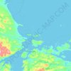
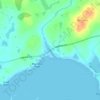
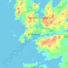
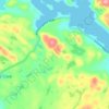
Eastport topographic map

Click on the map to display elevation.

About this map

Name: Eastport topographic map, elevation, terrain.

Location: Eastport, Newfoundland, Newfoundland and Labrador, A0G 1Z0, Canada (48.64342 -53.80965 48.74368 -53.61903)

Average elevation: 72 ft

Minimum elevation: -7 ft

Maximum elevation: 607 ft

Other topographic maps

Click on a map to view its topography, its elevation and its terrain.
Bell Island

Canada > Newfoundland and Labrador

Average elevation: 30 ft

Labrador

Canada > Newfoundland and Labrador

Average elevation: 2,211 ft

Englee

Canada > Newfoundland and Labrador > Englee

Average elevation: 112 ft

Mount Caubvick

Canada > Newfoundland and Labrador

Average elevation: 4,173 ft

Whitbourne

Canada > Newfoundland and Labrador > Whitbourne

Average elevation: 230 ft

Highway 220

Canada > Newfoundland and Labrador

Average elevation: 26 ft

Grosse Point

Canada > Newfoundland and Labrador

Average elevation: 82 ft
Bridgeport

Canada > Newfoundland and Labrador

Average elevation: 72 ft

Ragged Point

Canada > Newfoundland and Labrador

Average elevation: 20 ft

Monroe

Canada > Newfoundland and Labrador

Average elevation: 135 ft

Smokey

Canada > Newfoundland and Labrador > Smokey

Average elevation: 46 ft

Tims Hill

Canada > Newfoundland and Labrador

Average elevation: 413 ft

Gear up for your next adventure:

🪶Survival Guide Book - Expert advice for emergency preparedness
🧦Hiking Socks - Comfortable socks to prevent blisters on long hikes
🛡️Insect Repellent - Protection against bugs during outdoor activities
🌡️Portable Weather Meter - Track weather conditions on the trail
🔪Outdoor Multitools - Essential survival tools for gear repair and field use

As an Amazon Associate, this site earns from qualifying purchases at no extra cost to you.