Geolocate

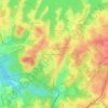
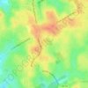
Mulberry topographic map

Click on the map to display elevation.

About this map

Name: Mulberry topographic map, elevation, terrain.

Location: Mulberry, Gwinnett County, Georgia, United States (34.00497 -83.94715 34.11832 -83.83276)

Average elevation: 1,060 ft

Minimum elevation: 814 ft

Maximum elevation: 1,273 ft

Gwinnett County trails, hiking, mountain biking, running and outdoor activities

Other topographic maps

Click on a map to view its topography, its elevation and its terrain.
Berkeley Hills

United States > Georgia > Gwinnett County

Average elevation: 958 ft

Northwest Harbor

United States > Georgia > Gwinnett County > Buford

Average elevation: 1,115 ft

Ridgewood

United States > Georgia > Gwinnett County

Average elevation: 1,086 ft

Springlake Estates

United States > Georgia > Gwinnett County > Buford

Average elevation: 1,158 ft

Mountain Park

United States > Georgia > Gwinnett County

Average elevation: 958 ft

Settles Bridge

United States > Georgia > Gwinnett County > Suwanee

Average elevation: 1,030 ft

Northwest Harbor

United States > Georgia > Gwinnett County > Buford

Average elevation: 1,115 ft

Sweet Water Park

United States > Georgia > Gwinnett County

Average elevation: 958 ft

Gear up for your next adventure:

🎒Trail Energy Bars - High‑calorie bars for hiking energy
🔭Telescopic Hiking Pole - Adjustable pole for hiking stability
🧢Outdoor Hiking Hat - Sun protection hat for outdoor explorers
🪶Fire Starter Kit - Reliable fire starter for survival and camping
🥩Freeze-Dried Meals - Nutritious and lightweight food for remote expeditions

As an Amazon Associate, this site earns from qualifying purchases at no extra cost to you.