
多玛 topographic map
Interactive map
Click on the map to display elevation.
About this map
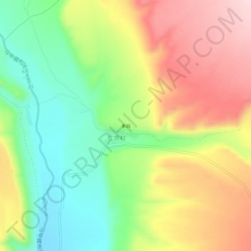
Name: 多玛 topographic map, elevation, terrain.
Location: 多玛, 普兰镇, 普兰县, 阿里地区, 西藏自治区, 中国 (30.43728 81.09749 30.47728 81.13749)
Average elevation: 13,714 ft
Minimum elevation: 13,281 ft
Maximum elevation: 14,216 ft
Other topographic maps
Click on a map to view its topography, its elevation and its terrain.