
西德村(行政村) topographic map
Interactive map
Click on the map to display elevation.
About this map
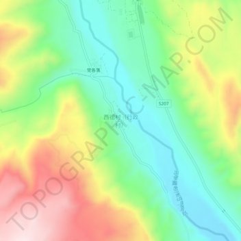
Name: 西德村(行政村) topographic map, elevation, terrain.
Location: 西德村(行政村), 普兰镇, 普兰县, 阿里地区, 西藏自治区, 中国 (30.22661 81.16130 30.26661 81.20130)
Average elevation: 13,018 ft
Minimum elevation: 12,388 ft
Maximum elevation: 13,973 ft
Other topographic maps
Click on a map to view its topography, its elevation and its terrain.