
普兰县 topographic map
Interactive map
Click on the map to display elevation.
About this map
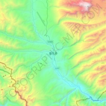
Name: 普兰县 topographic map, elevation, terrain.
Location: 普兰县, 普兰镇, 普兰县, 阿里地区, 西藏自治区, 中国 (30.13620 81.01478 30.45620 81.33478)
Average elevation: 15,696 ft
Minimum elevation: 11,942 ft
Maximum elevation: 25,121 ft
Other topographic maps
Click on a map to view its topography, its elevation and its terrain.