
Converse topographic map
Click on the map to display elevation.
About this map
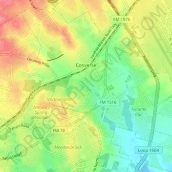
Name: Converse topographic map, elevation, terrain.
Location: Converse, Bexar County, Texas, 78109, United States (29.48266 -98.34220 29.53863 -98.27366)
Average elevation: 732 ft
Minimum elevation: 614 ft
Maximum elevation: 876 ft
Bexar County trails, hiking, mountain biking, running and outdoor activities
Other topographic maps
Click on a map to view its topography, its elevation and its terrain.
Medina River Natural Area
United States > Texas > Bexar County > San Antonio
Average elevation: 551 ft