
Muscle Shoals topographic map
Click on the map to display elevation.
About this map
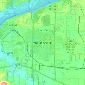
Name: Muscle Shoals topographic map, elevation, terrain.
Location: Muscle Shoals, Colbert County, Alabama, United States (34.69182 -87.68022 34.79579 -87.56126)
Average elevation: 512 ft
Minimum elevation: 413 ft
Maximum elevation: 840 ft
Colbert County trails, hiking, mountain biking, running and outdoor activities
Other topographic maps
Click on a map to view its topography, its elevation and its terrain.
River Oaks
United States > Alabama > Colbert County > Sheffield > River Oaks
Average elevation: 495 ft