Geolocate

Barton topographic map

Click on the map to display elevation.

About this map

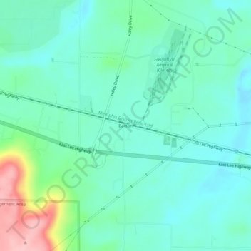
Name: Barton topographic map, elevation, terrain.

Location: Barton, Colbert County, Alabama, United States (34.71870 -87.91115 34.75870 -87.87115)

Average elevation: 525 ft

Minimum elevation: 407 ft

Maximum elevation: 919 ft

Colbert County trails, hiking, mountain biking, running and outdoor activities

Other topographic maps

Click on a map to view its topography, its elevation and its terrain.

Tuscumbia

United States > Alabama > Colbert County

Average elevation: 522 ft

Leighton

United States > Alabama > Colbert County

Average elevation: 574 ft

Muscle Shoals

United States > Alabama > Colbert County

Average elevation: 512 ft

Leighton

United States > Alabama > Colbert County

Average elevation: 574 ft

Muscle Shoals

United States > Alabama > Colbert County

Average elevation: 512 ft

Cherokee

United States > Alabama > Colbert County

Average elevation: 541 ft

Sportsplex

United States > Alabama > Colbert County > Muscle Shoals

Average elevation: 509 ft

Leighton

United States > Alabama > Colbert County

Average elevation: 577 ft

Gear up for your next adventure:

🛏️Cold Weather Sleeping Bag - Warm sleeping bag for cold conditions
🪓Survival Multi‑Tool - Versatile tool for camp and trail tasks
🌡️Portable Weather Meter - Track weather conditions on the trail
🧯Portable Fire Pit - Compact fire pit for camping spots
Solar GPS Watches - Advanced multisport watches with built-in topographic maps

As an Amazon Associate, this site earns from qualifying purchases at no extra cost to you.