
Leighton topographic map
Click on the map to display elevation.
About this map
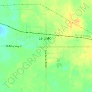
Name: Leighton topographic map, elevation, terrain.
Location: Leighton, Colbert County, Alabama, United States (34.69131 -87.53792 34.70589 -87.52023)
Average elevation: 577 ft
Minimum elevation: 525 ft
Maximum elevation: 623 ft
Other topographic maps
Click on a map to view its topography, its elevation and its terrain.
River Oaks
United States > Alabama > Colbert County > Sheffield > River Oaks
Average elevation: 495 ft