
Make a donation
Gear up for your next adventure:
As an Amazon Associate, this site earns from qualifying purchases at no extra cost to you.
Park City topographic map
Click on the map to display elevation.
Make a donation
Gear up for your next adventure:
As an Amazon Associate, this site earns from qualifying purchases at no extra cost to you.
About this map
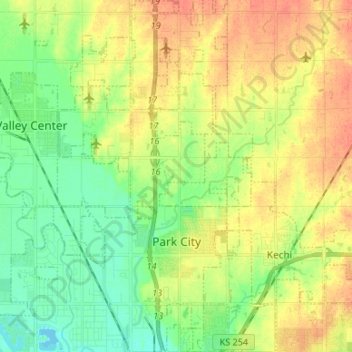
Name: Park City topographic map, elevation, terrain.
Location: Park City, Sedgwick County, Kansas, United States (37.76676 -97.35357 37.87191 -97.29495)
Average elevation: 1,381 ft
Minimum elevation: 1,312 ft
Maximum elevation: 1,460 ft
Sedgwick County trails, hiking, mountain biking, running and outdoor activities
Make a donation
Gear up for your next adventure:
As an Amazon Associate, this site earns from qualifying purchases at no extra cost to you.
Other topographic maps
Click on a map to view its topography, its elevation and its terrain.
Valley Center
United States > Kansas > Sedgwick County > Valley Center > Valley Center
Average elevation: 1,362 ft